| Address | 169-7, Gongwon-gil, Cheongsong-gun, Gyeongsangbuk-do |
|---|---|
| Area | Gyeongbuk |
| Type | Tourist attraction |
| Phone | • 1330 Travel Hotline: +82-2-1330 (Korean, English, Japanese, Chinese) • For more info: +82-54-870-5300 |
| Website | http://juwang.knps.or.kr |
| Directions | Naver Map Kakao Map Google Maps Google Maps has no turn-by-turn directions in Korea. Why |
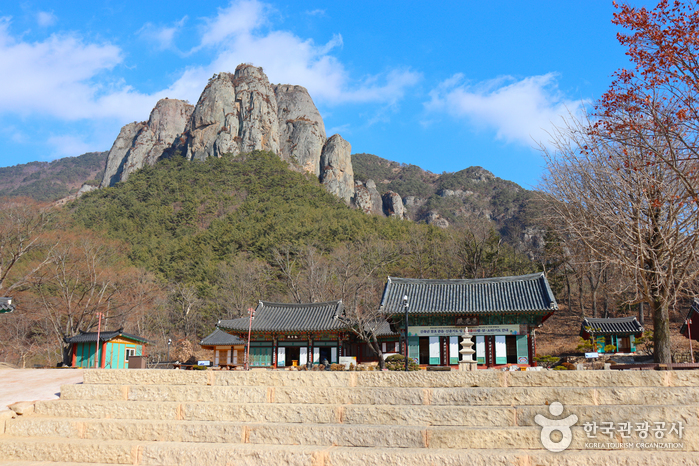
Juwangsan Mountain (alt. 720.6 m) is located in the Baekdudaegan Mountain Range, the backbone of the Korean peninsula. The mountain features deep valleys and many sheer rock cliffs to make it the third-largest rocky mountain in the country. Juwangsan Mountain was recognized as a tourist attraction on May 30, 1972, and became the 12th national park a few years later on March 30, 1976.
The park is relatively small, filling in an area of just 105.582 ㎢ but it is great for a leisure walk with walking trails along the valleys up to waterfalls.
Juwangsan Mountain was called Seokbyeongsan Mountain during the Silla dynasty due to the many stone peaks jutting out but has been called Juwangsan Mountain since the Unified Silla period. In addition to these tall rocky peaks, Juwangsan National Park also includes four waterfalls, caves, Daejeonsa Temple, and other attractions for a comprehensive tourist site.
The links below are affiliate links. If you book through them this site earns a commission at no extra cost to you. How this works.
Book something nearby

While you are there

Read before you go
Source: Korea Tourism Organization (TourAPI). Listing generated 2026-08-27 16:37 UTC; details can change — check the official page before you go.